Published : 2025-08-26
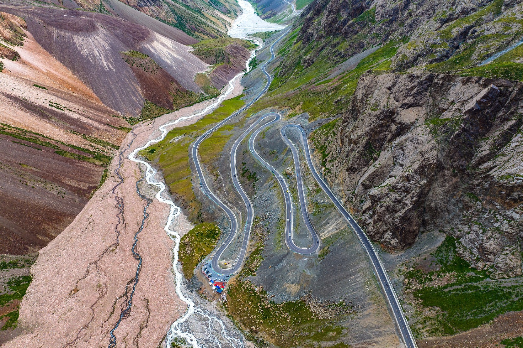
The Duku Highway (獨庫公路), renowned as the "Most Scenic Road in China's Xinjiang", has reopened this year! Only open for four months each year, the Duku Highway stretches 561 km and traverses the Tianshan Mountains from north to south.
This article focuses on four remarkable geological wonders along the Duku Highway, guiding you to trace the hundreds of millions of years of geological history etched into the Tianshan Mountains.
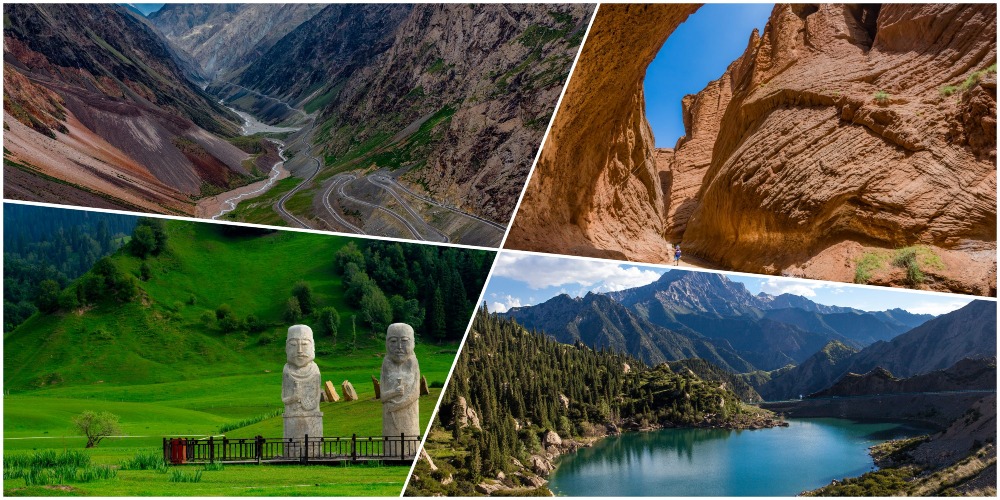
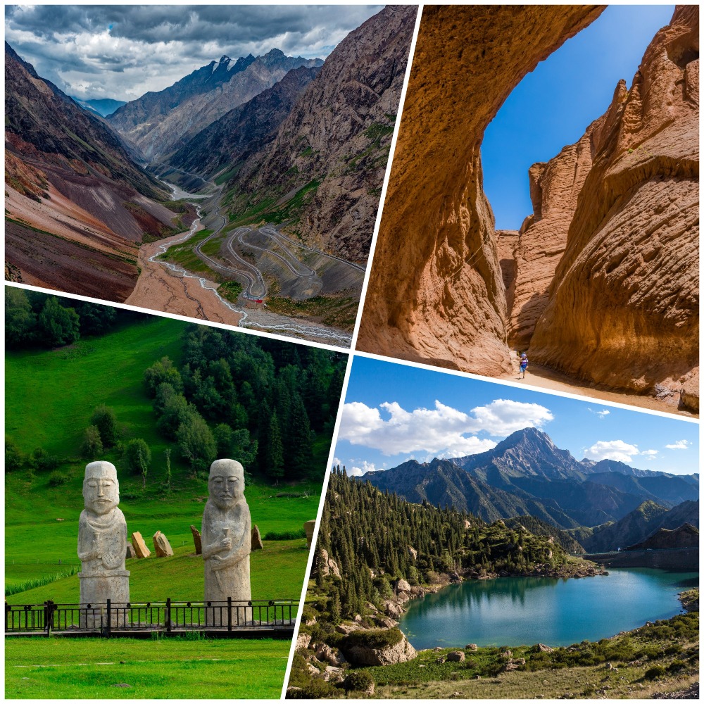
Hashilegen Daban
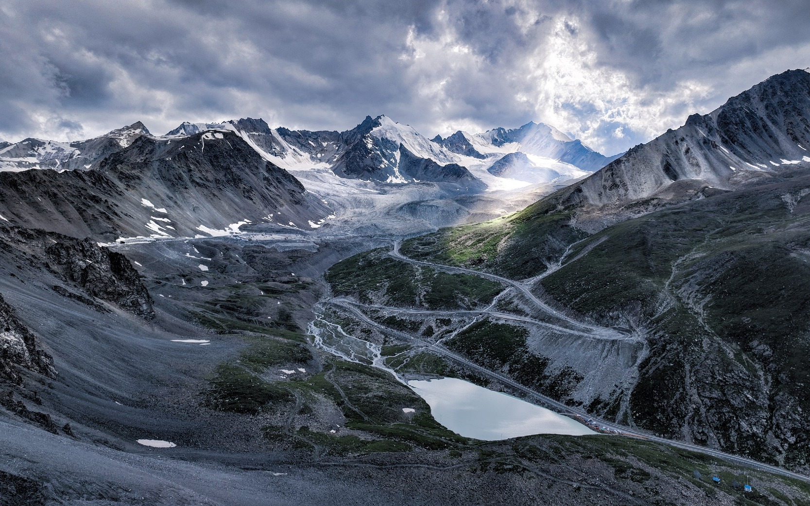
As the highest point of the Duku Highway (about 3,400 metres), Hashilegen Daban (哈希勒根達坂) is like a silver threshold, gently separating the desert of northern Xinjiang from the oasis of southern Xinjiang.
Glaciers that do not melt all year round spread across the mountain peaks, sparkling like crushed diamonds under the sunlight. At the foot of the mountains, the spruce trees on snow ridge pile up along the slopes, creating a strong visual impact with the collision of green and white.


The most unique feature of Hashilegen Daban is the "snow protection gallery" in the middle section, with a hundred-metre-long steel frame gallery like a giant python lying on the mountainside.
It not only shields the road from being buried by winter blizzards but also serves as a natural viewing platform.
Standing here and looking down, streams formed by glacier meltwater rush through the canyon, and the silhouette of Dushanzi Grand Canyon (獨山子大峽谷) can faintly be seen in the distance, as if you can hear the echoes of the geological movement of Tianshan Mountains.
Travel Tips: Due to the high elevation, mild altitude sickness may occur, so it is recommended to walk slowly; even in summer, the temperature here can still drop to around 10°C, so bring please warm clothing.
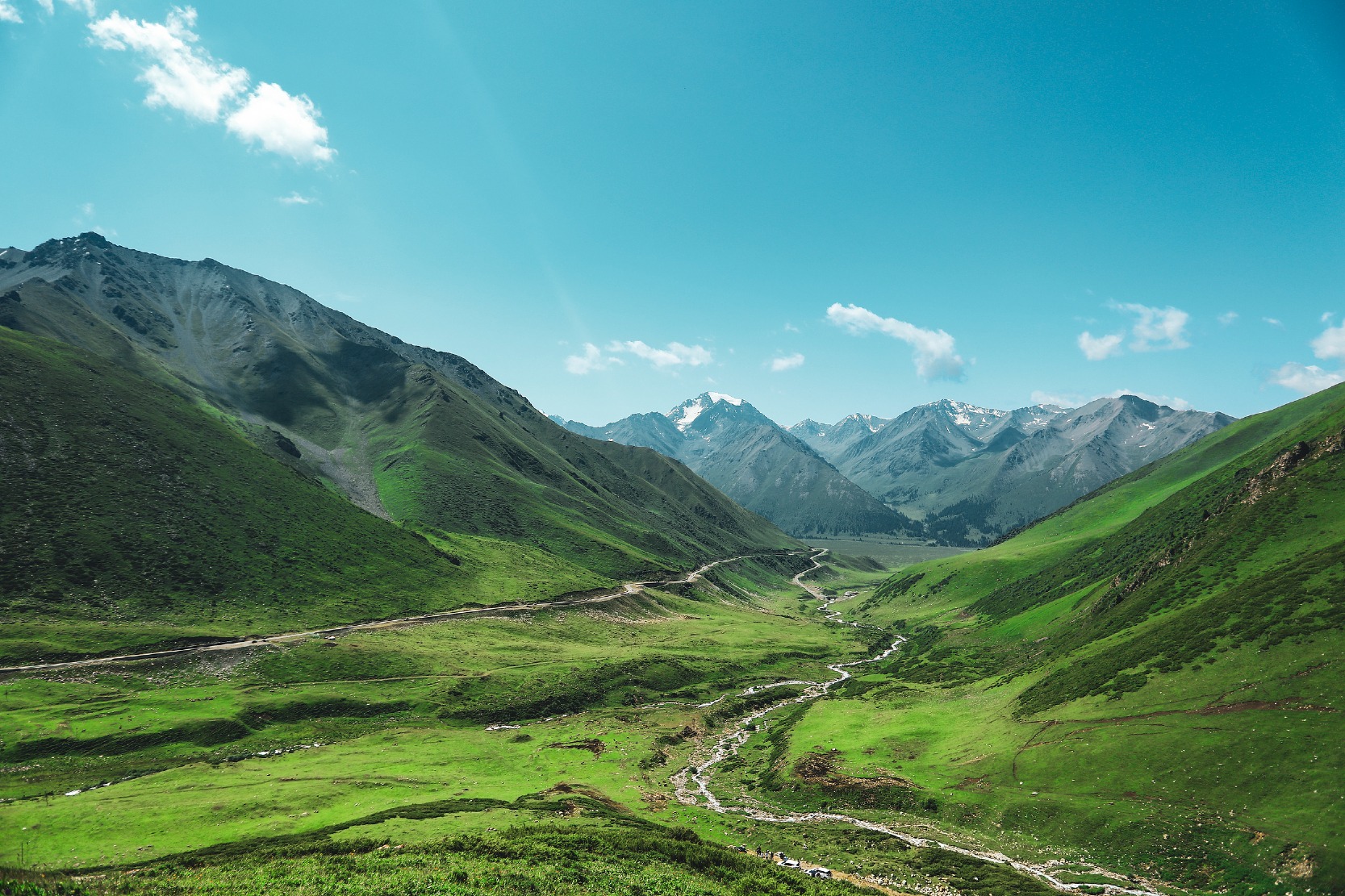
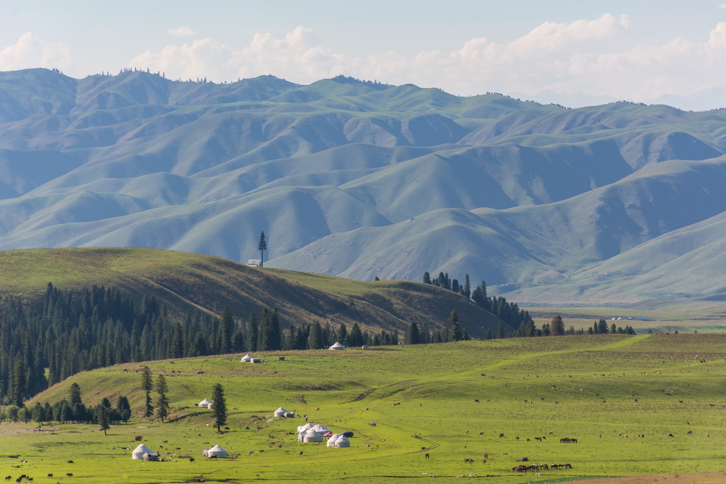
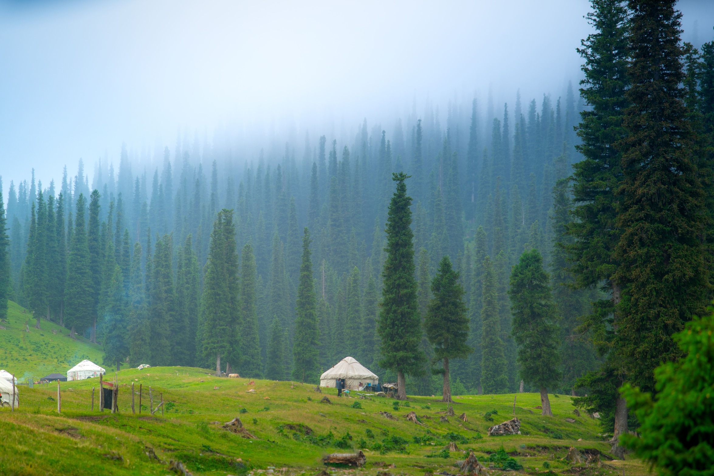
Nalati Grassland
Driving south from Hashilegen Daban for an hour, the Duku Highway suddenly presents a large area of three-dimensional green — the Nalati Grassland (那拉提草原), like an emerald held in the palm of Tianshan Mountains. Its 2,000 metres elevation gives it the name "Aerial Grassland".
Unlike plains grasslands, the green here is "flowing".
River valleys and streams wind around the meadows; wildflowers weave stripes of orange, yellow, pink, and purple on the slopes; cattle and sheep move slowly under the shadows of the clouds; and the distant snow peaks stand quietly like background boards.


The thin morning mist is the "magical moment" of the Nalati Grassland. The mist rises from the valley, entwines the fir tree forests, and turns the distant yurts into vague silhouettes, making the whole grassland appear as if it's floating in midair.
By noon when the mist disperses, sunlight penetrates the clouds, and dew drops on the grass blades refract rainbows.
Any snap taken resembles scenes from a Hayao Miyazaki animation, making it feel like being in a fairy tale world.
Travel Tips: Hike the river valley pasture trail to witness herders' daily life: milking cows and cutting grass. At dusk, the sunset viewpoint offers golden-hour shots of snow-capped peaks meeting the grasslands.
Read more: "Rainbow on the ground" in China's Xinjiang
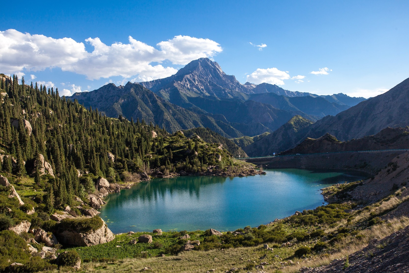
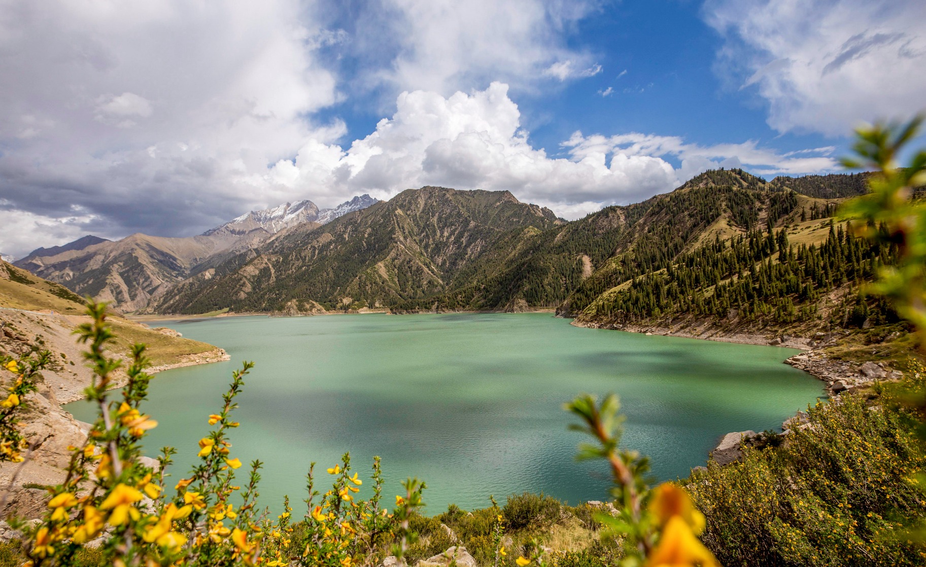
The large and small Dragon Pools
After crossing the Nalati Grassland, the Duku Highway begins to enter the heartland of the Tianshan Mountains. Not far away, two highland lakes are nestled in the valley, known locally as the "Eyes of Tianshan."
They are the Large Longchi and the Small Longchi (龍池), which means "dragon pool".
The Large Longchi is vast and mirror-like, with emerald-green water reflecting snow mountains and fir trees. The pebbles on the shore are polished smooth by the water.
The Small Longchi hides next to a canyon tributary. Although smaller, it has shallower, highly transparent water, clearly displaying the deadwood and fish at the bottom of the lake.


The water in both large and small Longchi originate from the meltwater of Tianshan glaciers. Due to their different mineral content, they present a a striking colour contrast—one appearing deep green, the other light blue.
In the early morning, the surface of Longchi lakes appears like frozen glass. Reflections of snow mountains, fir trees, and birds simultaneously appear, making it hard to distinguish reality from its mirror image—truly dreamy.
Travel Tips: Kazakhs nearby sell freshly brewed milk tea and bread (Nang) by the lake. Take a break here; portable rain gear is advised as there can be occasional hailstorms in summer.
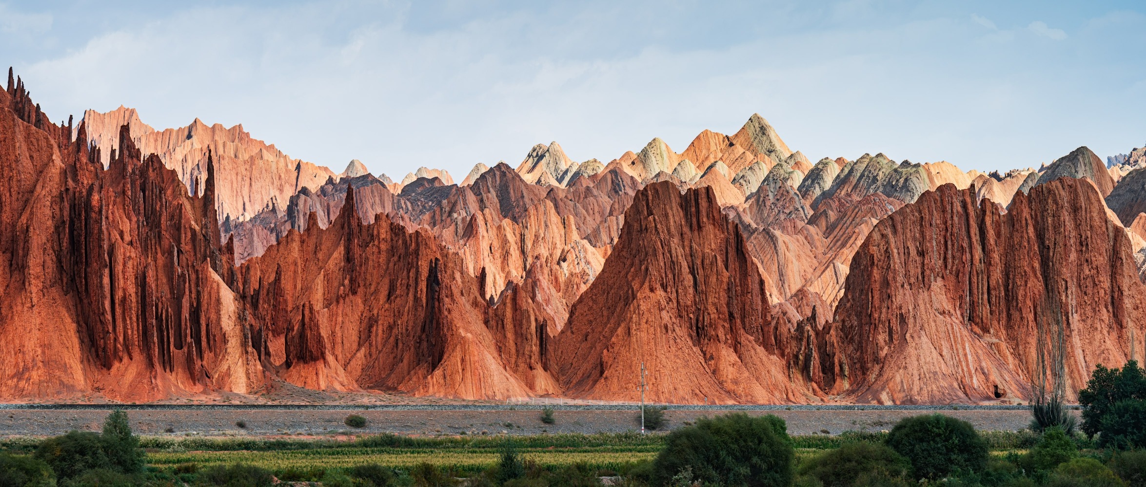
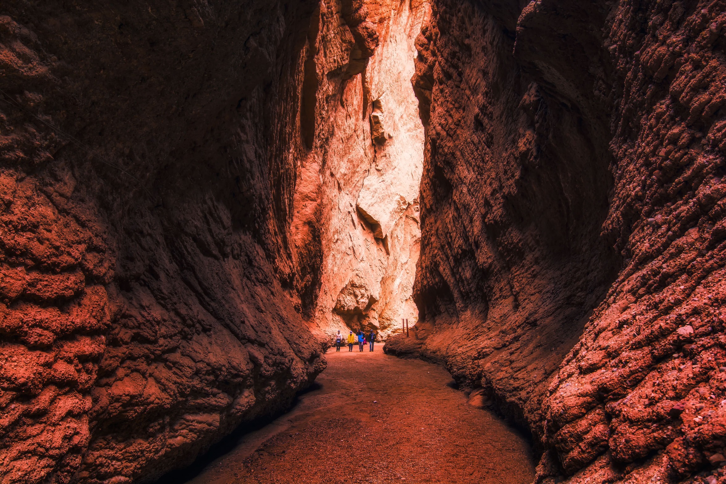
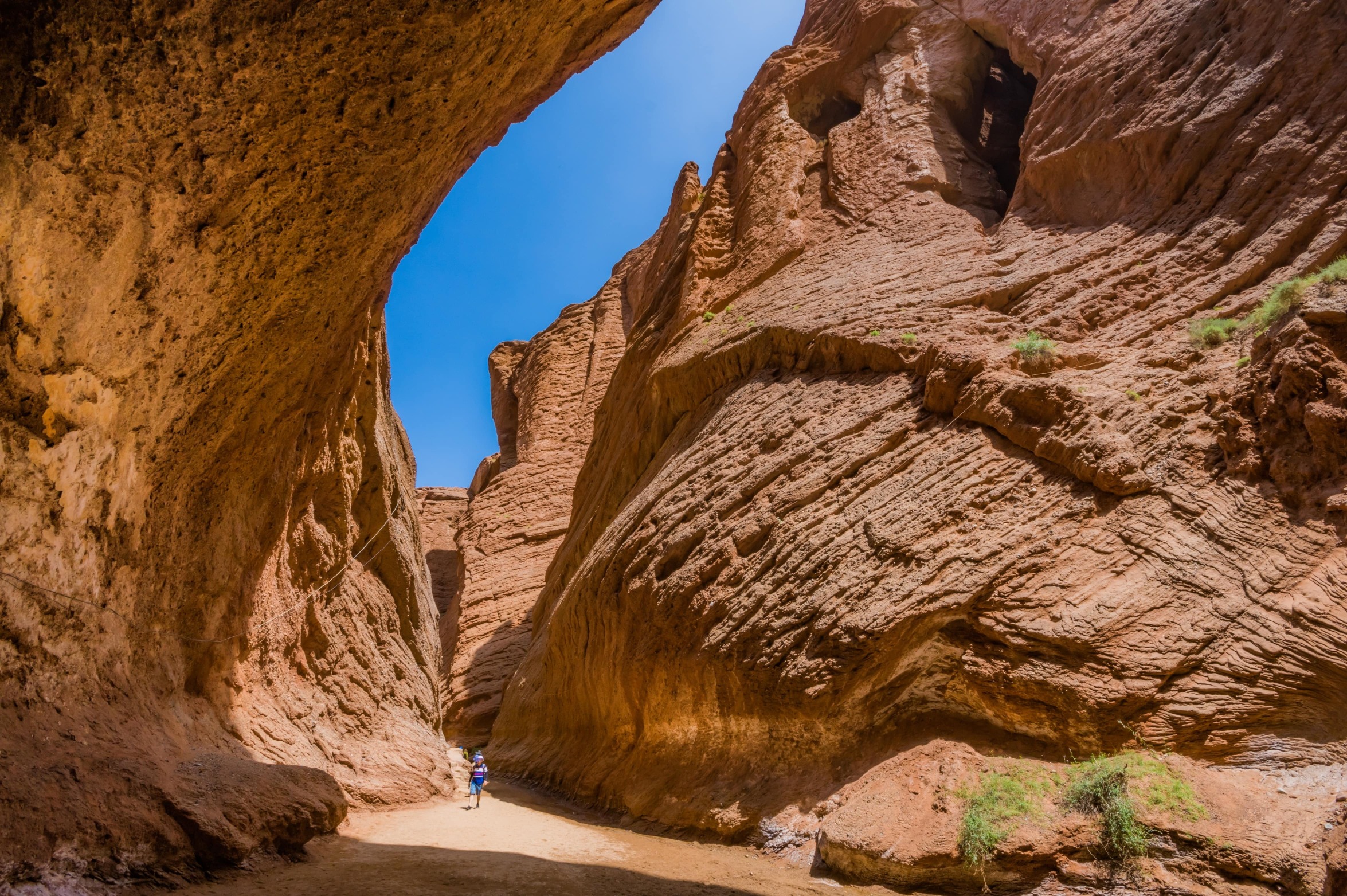
Tianshan Mysterious Grand Canyon
The last stop, we arrive at the Mysterious Grand Canyon of Tianshan located near the end of the Duku Highway.
The Mysterious Grand Canyon of Tianshan, also known as the Kuqa Grand Canyon (庫車大峽谷) or the Kizilya Grand Canyon (克孜爾亞大峽谷), is made of red sandstone and stretches for 5.5 km.
Over billions of years, these red sandstones have formed bizarre shapes due to wind and water erosion—some look like castles, others like beasts.
The narrowest point allows only one person to pass sideways, with a "one-line sky" visible above.


At noon, light penetrates through the gaps at the top of the canyon, casting flowing shadows on the rock walls.
The red rocks appear to be on fire; in the early morning or late afternoon, when the sunlight is oblique, the rock walls exhibit gradient colours such as orange-red, dark red, and ochre, presenting different colour variations.
Travel Tips: There is no shade in the canyon, and the temperature can reach up to 40℃ at noon in summer. It is advisable to enter before 9 AM or after 6 PM; some sections require climbing, so wearing non-slip shoes is safer.
From glaciers to red canyons, the natural attractions along the Duku Highway showcase the rich natural landscapes of the Tianshan region.
Continuing along the highway, you will also encounter attractions with cultural significance. These spots carry history and stories. In the next section, we will uncover the scenes engraved with stories along the Duku Highway.
Read more: China's Wangxian Valley: A fairyland with cliffside houses


